Tiling System
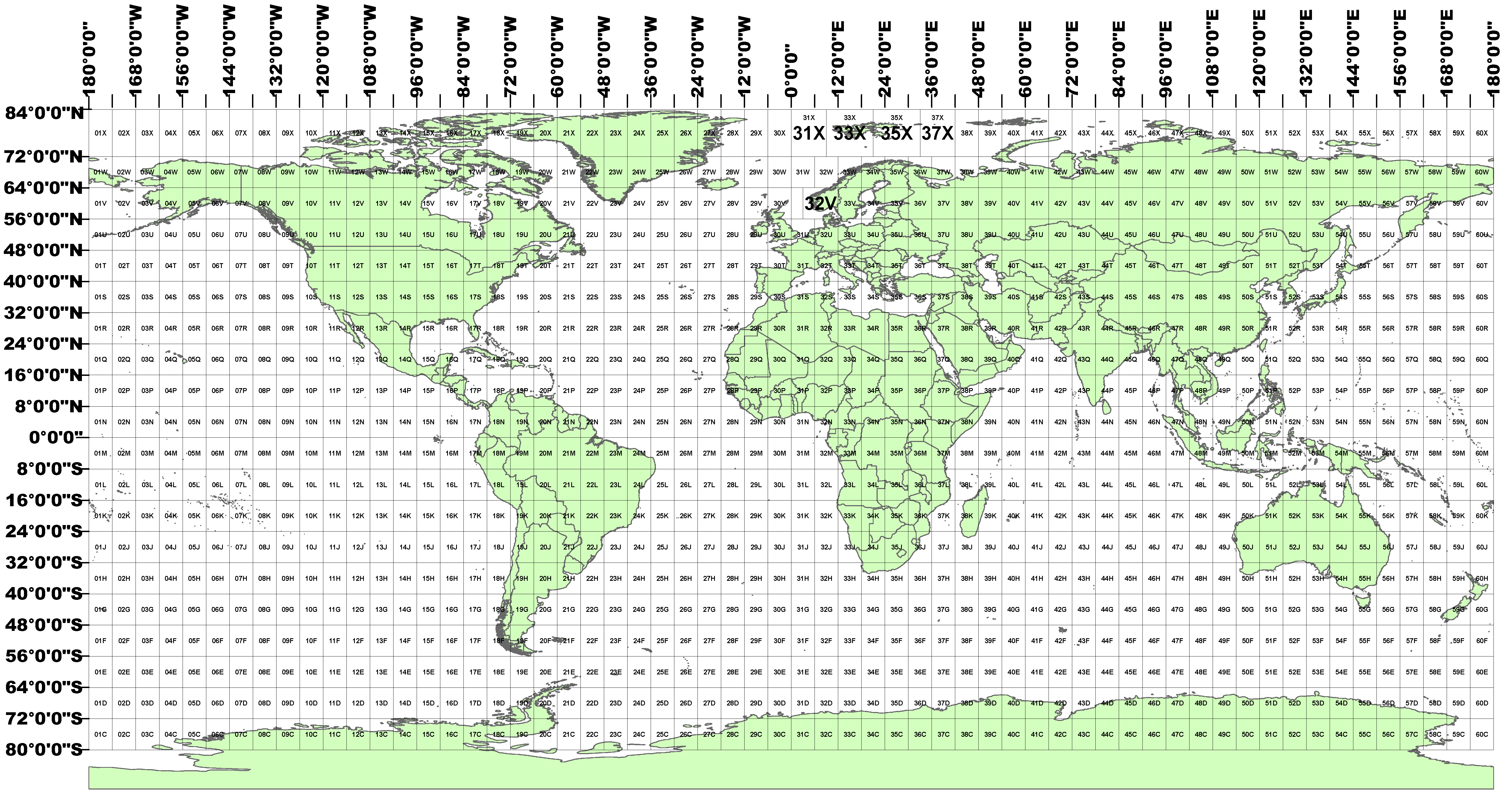
HLS has adopted the tiling system used by ESA for Sentinel-2. The tiling system is a slightly modified Military Grid Reference System (MGRS) which is based on the Universal Transverse Mercator (UTM) projection. The MGRS system equally divides the Earth’s surface into 60 zones by longitude, and each UTM zone is further divided into latitude bands of 8 degrees starting with the equator; minor boundary adjustment is necessary for geopolitical considerations in rare cases. For Sentinel-2 images, each 6° x 8° grid cell is further divided into 109.8 km × 109.8 km tiles. There is an overlap of around 4,900 m between adjacent tiles within the same UTM zone and on the UTM zone border there is greater overlap with tiles from the adjacent UTM zone. In a tile designation such as 11SUJ, the first 2 digits and the following 1 letter correspond to the UTM zone and latitude band respectively, and the two last letters, with horizontal and vertical denotation, correspond to a 109.9 km square tile in the 6° x 8° grid cell.
The Sentinel-2 tiling system kml provided by ESA can be downloaded here.